Executive summary
Nubo Sphere measures unintended, fugitive methane emissions at oil and gas sites using a combination of purpose-built sensor technology, an informed siting procedure and advanced analytics. In part one of this series (available here) we looked at how the photoacoustic-based laser spectroscopy Nubo Sphere methane sensor provides the most accurate raw data on methane concentrations in air. In this article, we look at the Nubo Sphere siting procedure.
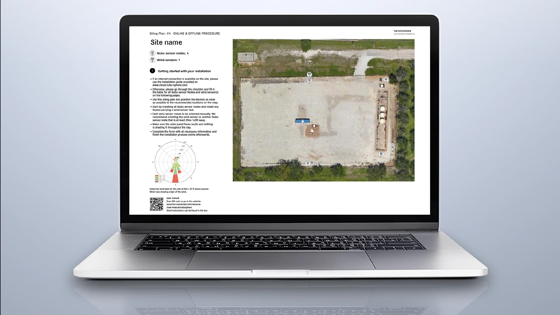
Siting plays two roles in effective emissions monitoring. First, it optimizes sensor placement, guaranteeing site coverage and maximizing the probability of detecting emissions while ensuring regulatory compliance and maintaining cost efficiency. Second, it’s a source of additional data, such as historical wind information and the height and location of equipment, that Nubo Sphere analytics use to form a complete picture of methane emissions.
This article explores in depth what information the Nubo Sphere siting procedure uses, and how this ensures comprehensive coverage of emissions sources and supports advanced analytics in the localization and quantification of methane emissions. This includes key insights into what oil and gas operators can expect when using Nubo Sphere. Read on to discover how many sensor nodes sites typically require, where sensors are best deployed and how the Nubo Sphere siting procedure uses wind data to guarantee site coverage.